File:1989 04 30.jpg
Size of this preview: 745 × 600 pixels. Other resolutions: 2,544 × 2,048 pixels | 3,324 × 2,676 pixels.
Original file (3,324 × 2,676 pixels, file size: 1.45 MB, MIME type: image/jpeg)
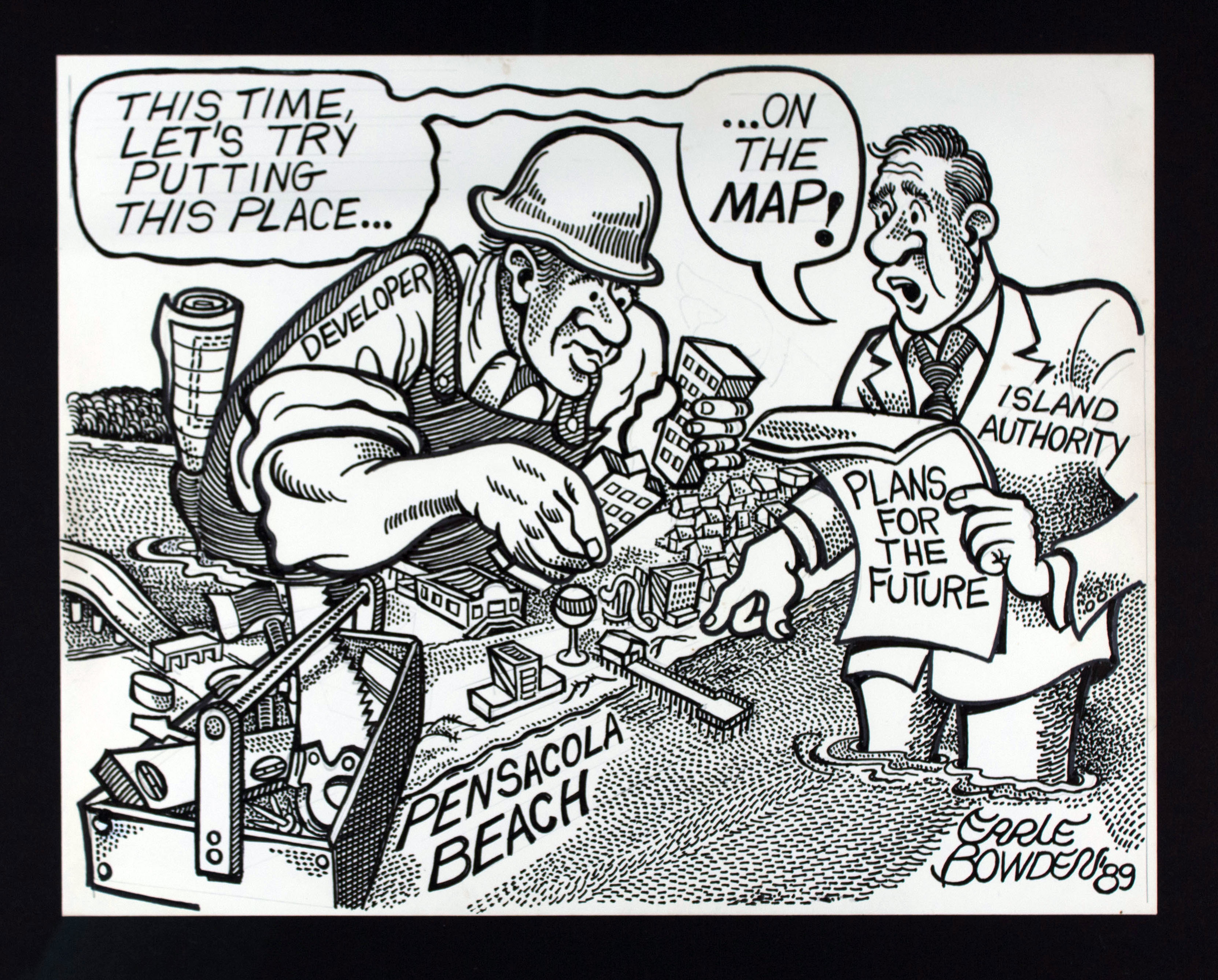
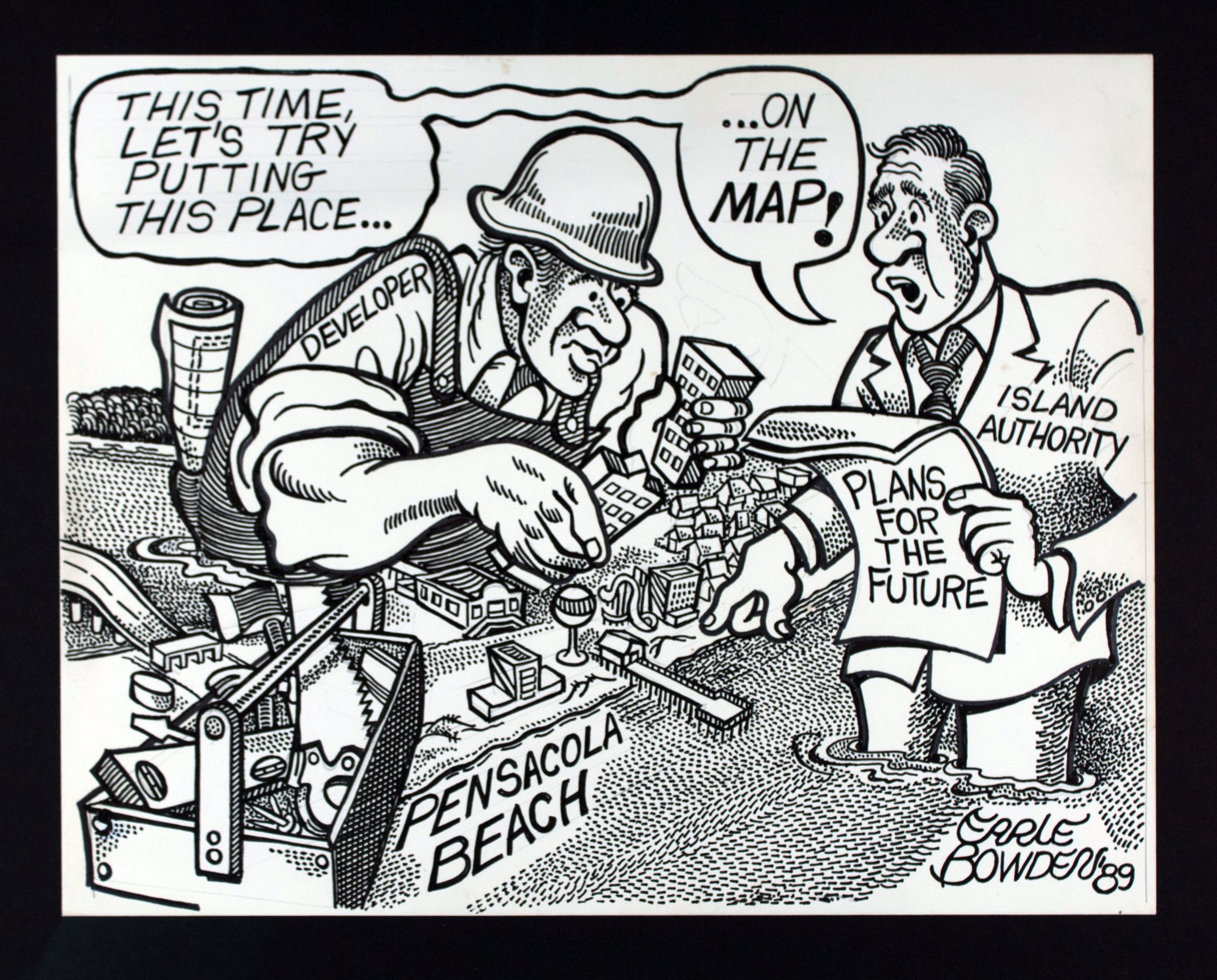
| Date Published: | 1989 April 30 PNJ |
| Title: | Putting The Place on the Map |
| Medium: | Ink on paper |
| Size: | 14 in. x 11 in. |
| Description/Context: | Accompanying editorial ‘Architectural guidelines foundation for progress’ noting the history of planning and architecture of Pensacola Beach under the Santa Rosa Island Authority and encouraging architectural and planning standards to put Pensacola Beach on the map. |
File history
Click on a date/time to view the file as it appeared at that time.
| Date/Time | Thumbnail | Dimensions | User | Comment | |
|---|---|---|---|---|---|
| current | 18:59, 4 June 2013 | | 3,324 × 2,676 (1.45 MB) | Alexander Vega (talk | contribs) |
You cannot overwrite this file.
File usage
There are no pages that use this file.