
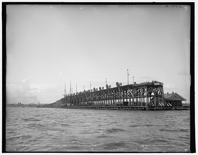
When travelling over Pensacola Bay Bridge, visitors and residents alike drive past one of the remaining pieces of evidence marking Escambia County’s substantial contribution to global industry. One half mile offshore, directly south of 12th avenue, sits two tall concrete structures that are remnants of Muscogee Wharf. After the railroads connected the Gulf Coast to inland resources in the 1870s, Pensacola began exporting significant quantities of lumber, coal, and bricks. Several railroad companies constructed wharves along the waterfront to facilitate the movement of goods from rail to ship. The Louisville and Nashville Railroad Company (L&N) owned Muscogee Wharf, among others, and relied on accurate navigation aids in the bay that allowed ships to dock alongside their pier. The system of buoys, range markers, and beacons guided commercial vessels all the way from the entrance of the bay to the downtown Pensacola wharves, creating aquatic highways that hundreds of ships traversed.
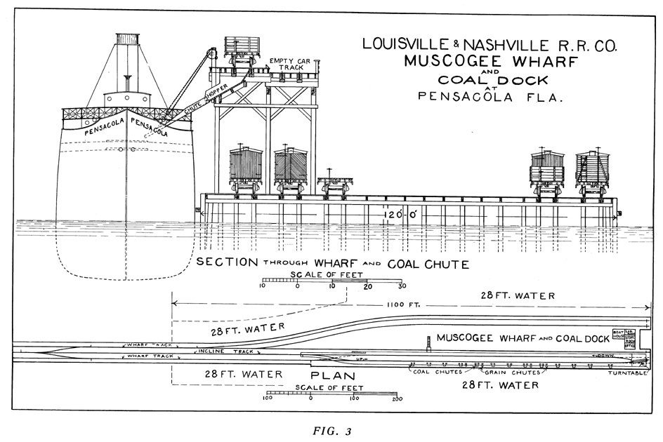
The Pensacola and Mobile Railroad Company constructed Muscogee Wharf in 1880 before selling it to L&N only six years later. According to a report on Pensacola Harbor and Its Advantages in 1901, the L&N Railroad had possession of the 2,440-foot-long wharf that went from only forty-six feet wide on land to “120 feet wide at sea end.” Muscogee Wharf had seven rail lines, including two elevated tracks that allowed gravity-fed chutes to transfer coal from the railcars to the ship’s cargo holds below. Wharves are vulnerable to strong currents and tend to suffer extreme damage during storms. Numerous hurricanes damaged Muscogee Wharf but the L&N rebuilt every time until 1955 when a major fire devastated the structure.
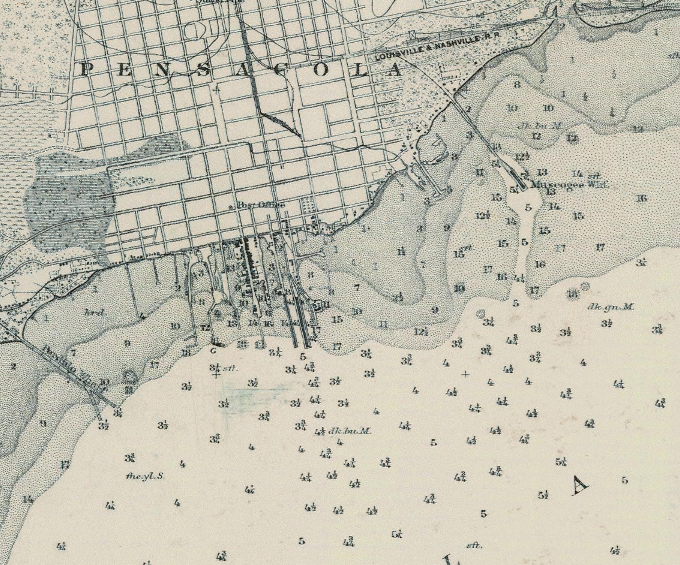
From 1880 until 1955, Muscogee Wharf served as both an export location for goods and a point of navigation for mariners in the bay. Rising nearly fifty feet in the air, the elevators worked as a fixed landmark that ships used to locate themselves, particularly when used in concert with the fifteen other wharves along the shoreline. Muscogee Wharf appears on nautical charts and in the Historic Coast Pilots, making it an important feature on the landscape.
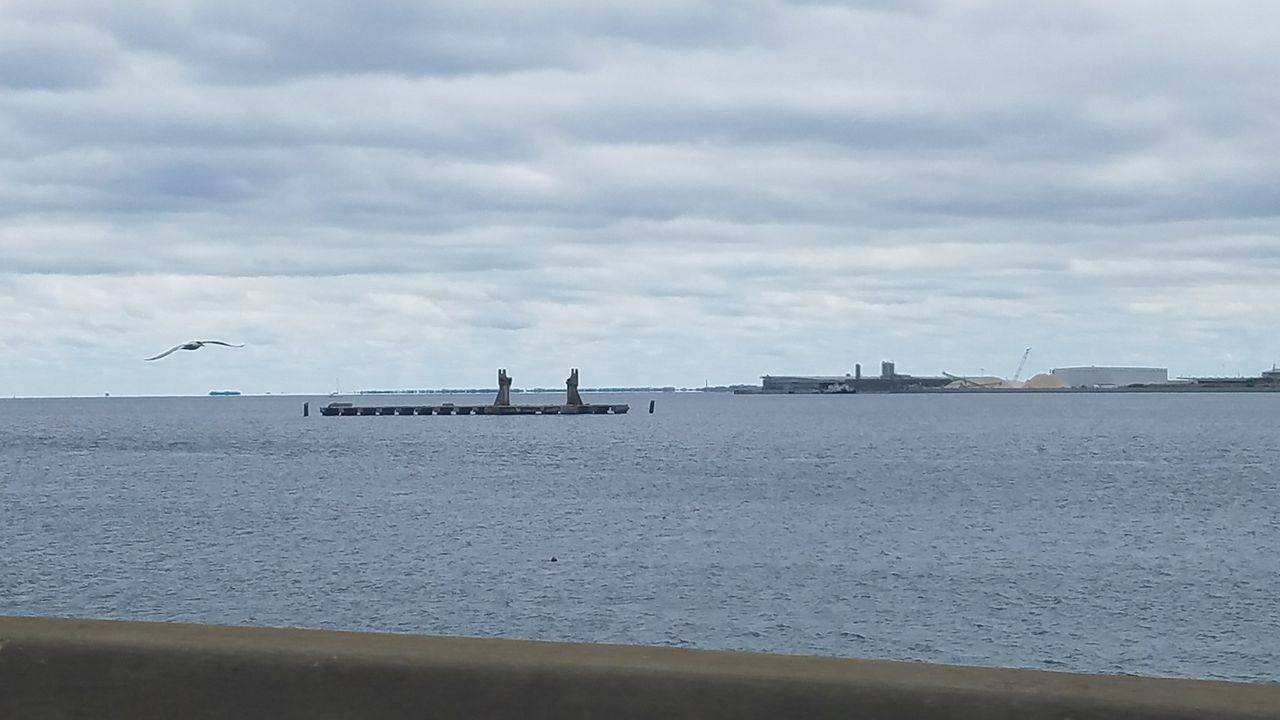
Today, the concrete piers serve as mooring points for barges as well as a handy perch for the sea birds to eat their lunch. Part of the tracks still lay submerged beneath the pilings, marking part of Pensacola’s industrial past from below the surface. The piers are a tangible reminder of the thriving commercial waterfront during the early half of the 20th century and retained their function as navigation markers long after the memory of industry faded.
Recommended Readings
Florida Historical Markers Programs. “Hawkshaw” South 10th Avenue, Pensacola, Florida. http://apps.flheritage.com/markers/markers.cfm?ID=escambia
Forbes, Jessica. “Pensacola’s Muscogee Wharf” inweekly. September 22, 2011. http://inweekly.net/wordpress/?p=7047
Louisville and Nashville Railroad Company. Pensacola harbor and its advantages. Louisville: Louisville & Nashville Railroad Co., 1901. State University Libraries of Florida PALMM Florida Heritage Collection. http://purl.flvc.org/fcla/dl/WF00000040.pdf
Featured Image:
Detroit Publishing Co., Publisher. Muscogee Wharf and coal docks, Pensacola, Fla. [Between 1900 and 1906] Photograph. Retrieved from the Library of Congress, https://www.loc.gov/item/det1994009086/PP/.
Author: Jessie Cragg
ORCID ID: 0000-0001-5133-8384