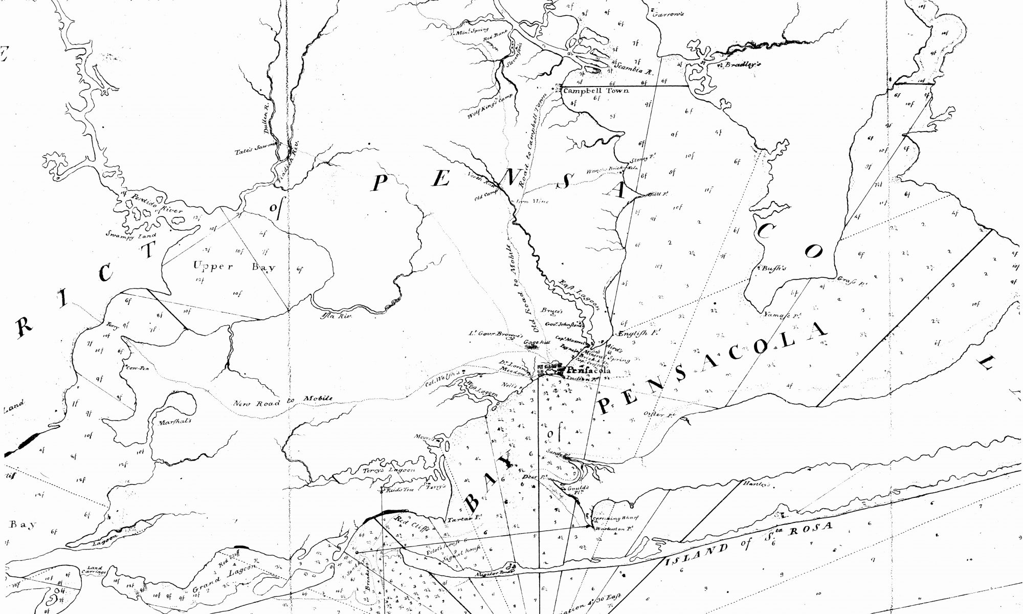
Just before the American Revolution, British soldiers and sailors occupied Pensacola. The city served as an outpost for England’s holdings in West Florida. In 1768, surveyor George Gauld arrived in the bay to create a map of the town. The hand-drawn map marked the most significant structures in Pensacola at the time, as well as the outlying areas. This map benefitted both government officials looking to better understand Pensacola’s layout, as well as allowed arriving ships safer navigation through the area.
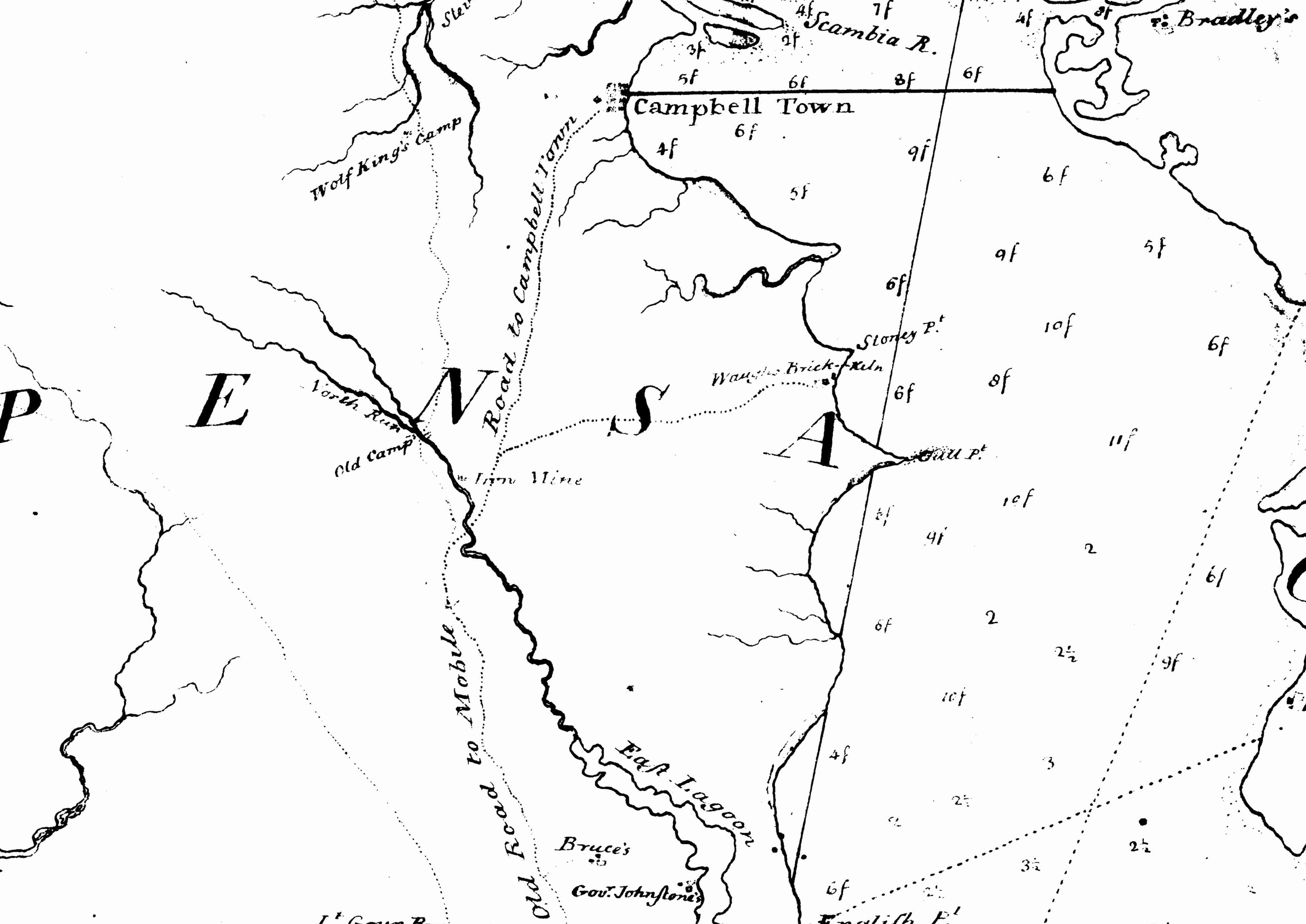
On this map, Gauld listed the location of Campbell Town, a colony of French Huguenot refugees, near present-day University of West Florida campus. The map shows only one road going between Campbell Town and Pensacola. This road closely follows the path of today’s Davis Highway. Even though features of the 1768 map of Pensacola bear little resemblance to those of modern Pensacola, the information it provides helps explain current infrastructure as well as displays significant changes over time.
Among the landmarks recorded near the entrance to Escambia Bay are Red Cliffs, Pilot’s House, and Reid’s Tree. The Red Cliffs are unique to Pensacola and guided early mariners into port as early as the Spanish occupation period in the 1600s. Once the United States issued written instructions, or Coast Pilots, for entering the bay, these documents also mentioned the Red Cliffs.
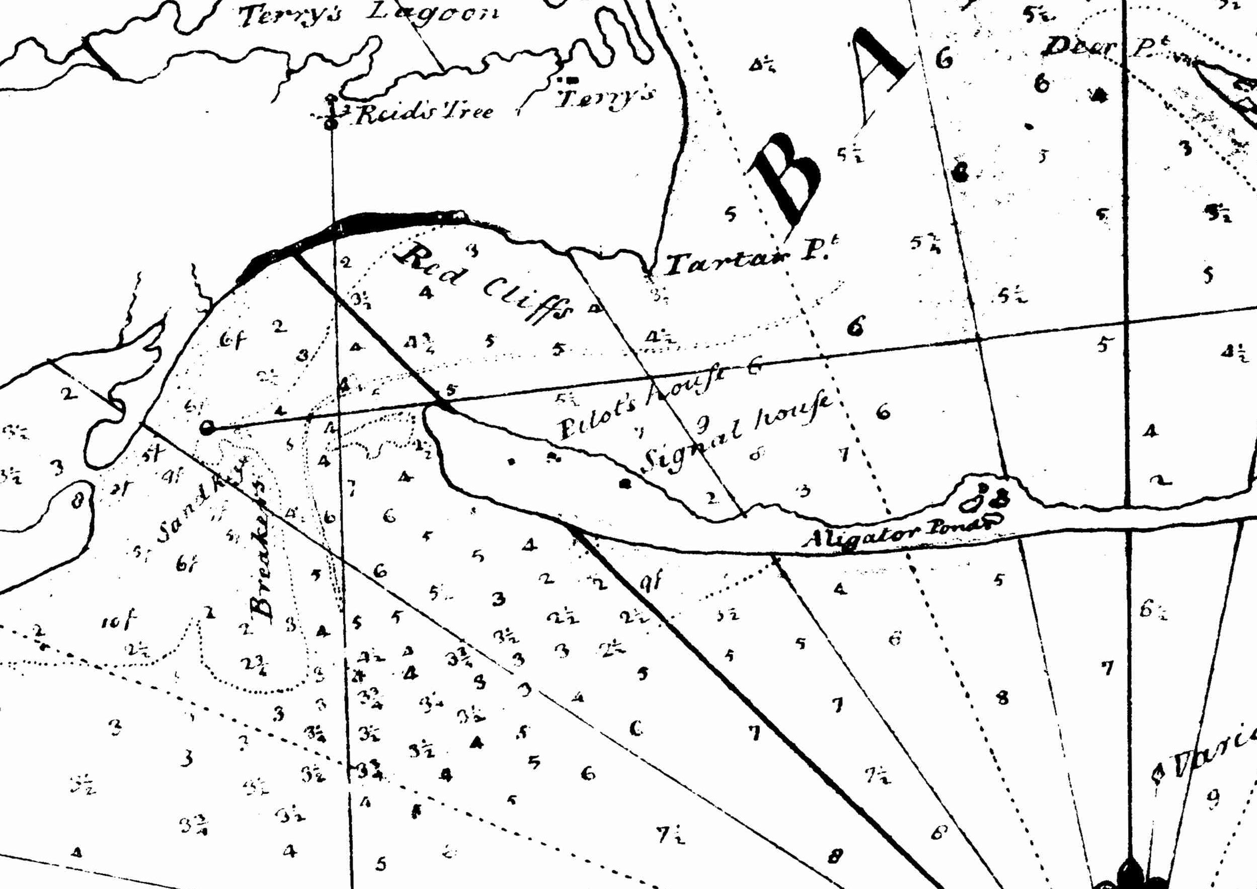
The Pilot’s House is also a critical navigation aid for incoming vessels. The sand bar at the mouth of the bay was a treacherous obstacle for incoming and outgoing sailors. Ships required skillful navigators with local knowledge of the bay, or pilots, to prevent running the deep drafts aground in the shallow waters. Reid’s Tree, named for an unknown Pensacola citizen, served as a triangulation point for ships crossing the bar. Thus, the tree was either taller than the surrounding foliage or its unique shape made it stand out among the others. Reid’s Tree is an example of non-traditional aids to navigation and a common method of visual bearing before modern positioning techniques. Today neither Reid’s Tree nor the Pilot’s house remain standing. It is possible they succumbed to either storms, logging, or any other unknown reason. These examples reveal how Pensacola’s landscape underwent significant changes in the near two and a half centuries since George Gauld recorded his detailed survey of the area. Nonetheless, his work serves as a starting point to trace the development of Pensacola’s heritage.
Recommended Readings
Conn, Richard. “Search Continues for Pensacola’s Lost Colonial-Era Settlement.” The Pulse. May 12, 2016. http://pulsegulfcoast.com/2016/05/search-continues-pensacolas-lost-colonial-era-settlement
Gauld, Charles A. “A Scottish View of West Florida in 1769.” Tequesta: Journal of the Historical Association of Southern Florida 29 (1969), 61-66. http://digitalcollections.fiu.edu/tequesta/files/1969/69_1_05.pdf
Johnson, Cecil. “Pensacola in the British Period: Summary and Significance.” The Florida Historical Quarterly 37, no. 3 (Spring 1959), 263-280.
Featured Image:
Gauld, George. “A Plan of the Bays of Pensacola and Mobile.” The Board of the Admiralty. 1768. University of West Florida Archives and West Florida History Center.
Author: Jessie Cragg
Researcher ID: 0000-0001-5133-8384